Client
City of Gold Coast
Scope
Impact
Related Projects
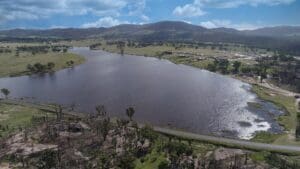
Tenterfield Shire Council
Tenterfield Dam Bathymetric Survey
WMS conducted a highly accurate bathymetric survey using a Sontek M9 ADCP to accurately determine the volume of water remaining in the dam and the volume of sediment.
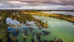
VIC Department of Environment, Land, Water and Planning (DELWP)
Lower Barwon River and Lower Moorabool River Flood Risk Management Study Review
NSW Department of Planning, Industry and Environment (DPIE)
Murray Land & Water Management
NSW DPIE engaged WMS to update the Murray LWMP salinity modelling framework using contemporary platforms