Design Of Drummond Creek Floodway | WMS Engineering
Peakvale Road, Clermont QLD, Australia

Design of Drummond Creek Floodway

A new floodway design improving flood immunity whilst maintaining design speed requirements
Monika Balicki
Questions? Get in touch today.
Monika Balicki

Client

Isaac Regional Council

Scope

Hydrologic and hydraulic modelling and flood impact assessment to inform a new floodway design

Impact

Final design of the upgraded Drummond Creek crossing including drawings, bill of quantities and cost estimate to enable Council to solicit bids for project construction
Monika Balicki
Questions? Get in touch today.
Monika Balicki

Client

Isaac Regional Council

Scope

Hydrologic and hydraulic modelling and flood impact assessment to inform a new floodway design

Impact

Final design of the upgraded Drummond Creek crossing including drawings, bill of quantities and cost estimate to enable Council to solicit bids for project construction

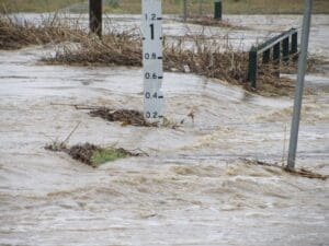
WMS, in collaboration with icubed consulting, was engaged by Isaac Regional Council to undertake the hydrologic and hydraulic analysis and design of the Drummond Creek floodway crossing upgrade.

The existing crossing was inundated and impassable several times a year. Two preliminary design options were developed to provide immunity for the 63.2% and 10% AEP events. Following the hydrologic and hydraulic assessment of the two preliminary design options and discussions with Council, the preferred design option for the Drummond Creek crossing upgrade was chosen. The final design for this option was however modified from the preliminary design with changes made to the width, alignment, crossfall and batters to ensure that the proposed roadworks will cater for the requirements of a 90 km/hr design speed environment.  The aim was to minimise the extent of these works while ensuring that the design speed was achieved.

Road near Drummond Creek
Drummond Creek

Several iterations of the design were tested, with model results used to inform the design process. Final design mapping and drawings as well as details on the scour assessment, proposed scour protection and flood impact assessment for the final design were provided. The bill of quantities and a detailed cost estimate to enable Council to solicit bids for project construction was also delivered as part of the project. 

Related Projects

Noosa Aerial photo
Sunshine Coast Council

Sunshine LGA Road Immunity Analysis

Semi-automated Tool Development
Local Government map
Toowoomba Regional Council

Whole of LGA Flood Mapping

A Rapid, Low Cost Alternative to Detailed Flood Studies
Jallara Park Drawing
Cairns Regional Council

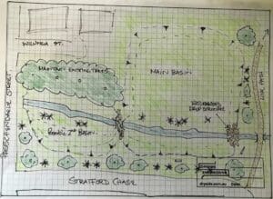
Jalarra Park Detention Basin

WMS teamed up with civil engineering firm Dryside Engineering to deliver the FIA and detailed design of the basin.
Hay Street Pedestrian Bridge
Brisbane City Council

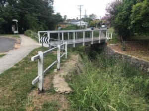
Hay Street Pedestrian Bridge Replacement

The objective of this project was to undertake hydraulic modelling and flood impact assessment to inform the design of the new bridge.
Sunshine Coast Storm Surge
Sunshine Coast Regional Council (SCRC)

Sunshine Coast Extreme Flood Hazard Mapping

Filling a Knowledge Gap on Flood Severity in Rare Events
Water Level @ Bendigo Creek, Bay Street Golden Square
City of Greater Bendigo Council

Kangaroo Flat and Golden Square Flood Mitigation Study

A wonderful collaboration between government bodies, experts and the community that delivered effective solutions to mitigate future flood events.
murray basin
NSW Department of Planning, Industry and Environment (DPIE)

Murray Land & Water Management

NSW DPIE engaged WMS to update the Murray LWMP salinity modelling framework using contemporary platforms