Toowoomba Second Range Crossing | WMS Engineering
Cranley QLD, Australia

Toowoomba Second Range Crossing

Infrastructure of national significance
Monika Balicki
Questions? Get in touch today.
Monika Balicki

Client

Toowoomba Regional Council

Scope

Flood impact assessments of two Toowoomba Bypass bridge crossings

Impact

Optimised hydraulic design and flood assessment reports for the Dry Creek and Gowrie Creek bridges, reviewed and approved by the Queensland Department of Transport and Main Roads
Monika Balicki
Questions? Get in touch today.
Monika Balicki

Client

Toowoomba Regional Council

Scope

Flood impact assessments of two Toowoomba Bypass bridge crossings

Impact

Optimised hydraulic design and flood assessment reports for the Dry Creek and Gowrie Creek bridges, reviewed and approved by the Queensland Department of Transport and Main Roads

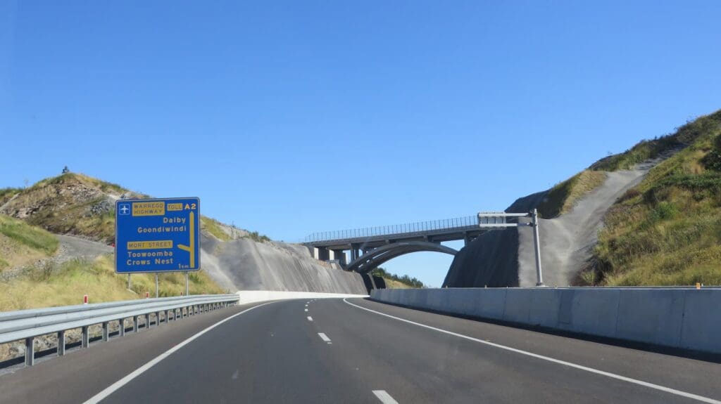
The Toowoomba Second Range Crossing provides commercial and heavy vehicles with an alternative crossing of the mountain range to the north of Toowoomba. The bypass not only addresses increasing transport demands from the region’s growing population, but will improve freight efficiency, driver safety and relieve pressure on Toowoomba’s roads. The 41 km-long bypass route runs from the Warrego Highway at Helidon in the east to the Gore Highway at Athol in the west, via Charlton. Construction of the project was awarded to the Nexus Infrastructure consortium and had a budget of $1.6 billion.

Toowomba Second Range Crossing

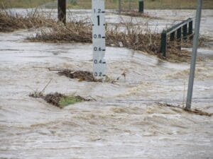
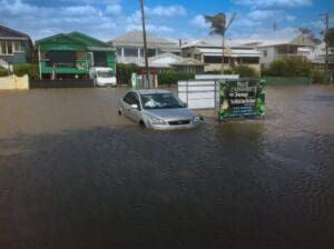
The route crosses several major creek systems that experienced devastating flooding in January 2011. WMS were engaged as contractors by Aurecon to work within the Nexus Infrastructure project team and assist with the flood impact assessments of the Dry Creek and Gowrie Creek crossings.

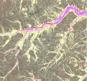
Toowoomba Regional Council had undertaken flood studies of the region for which WMS had played a crucial role. For Dry Creek, hydrologic and hydraulic models developed for these studies were utilised with appropriate upgrades including a new model topography and recalibration. For Gowrie Creek, a new 2D hydraulic model was developed. Within the Nexus Infrastructure project team, WMS worked to test multiple bridge and culvert arrangements to minimise flood impacts and scour potential. The primary outcomes of the project were detailed hydraulic designs and flood assessments of the crossings for Dry Creek and Gowrie Creek.

Related Projects

Road near Drummond Creek
Isaac Regional Council

Design of Drummond Creek Floodway

A new floodway design improving flood immunity whilst maintaining design speed requirements
Sunshine Coast Storm Surge
Sunshine Coast Regional Council (SCRC)

Sunshine Coast Extreme Flood Hazard Mapping

Filling a Knowledge Gap on Flood Severity in Rare Events
Noosa Aerial photo
Sunshine Coast Council

Sunshine LGA Road Immunity Analysis

Semi-automated Tool Development
Hay Street Pedestrian Bridge
Brisbane City Council

Hay Street Pedestrian Bridge Replacement

The objective of this project was to undertake hydraulic modelling and flood impact assessment to inform the design of the new bridge.
Water Level @ Bendigo Creek, Bay Street Golden Square
City of Greater Bendigo Council

Kangaroo Flat and Golden Square Flood Mitigation Study

A wonderful collaboration between government bodies, experts and the community that delivered effective solutions to mitigate future flood events.
Charters Towers river flood map
Charters Towers Regional Council

Charters Towers Retention Basin Modelling

Feasibility Assessment of Two Proposed Retention Basins
Pallamallawa and community involvement
Moree Plains Shire Council

PALLAMALLAWA LEVEE DESIGN REVIEW

WMS partnered with Dryside Engineering to deliver the Pallamallawa Northern Levee Second Design Review