Whole Of LGA Flood Mapping | WMS Engineering
Toowoomba Queensland, Australia

Whole of LGA Flood Mapping

A Rapid, Low Cost Alternative to Detailed Flood Studies
Monika Balicki
Questions? Get in touch today.
Monika Balicki

Client

Toowoomba Regional Council

Scope

Develop rapid, low cost flood mapping for the whole of Council LGA

Impact

Identify hot spot areas and inform emergency management and planning scheme updates in the absence of detailed information
Monika Balicki
Questions? Get in touch today.
Monika Balicki

Client

Toowoomba Regional Council

Scope

Develop rapid, low cost flood mapping for the whole of Council LGA

Impact

Identify hot spot areas and inform emergency management and planning scheme updates in the absence of detailed information

In 2013, Toowoomba Regional Council (TRC) embarked on a process of undertaking flood studies for 35 townships within the LGA for the purpose of informing a planning scheme update, emergency management and infrastructure planning. The extent of these studies mapped 22% of the 13,000 km² LGA.  Although a very large undertaking, significant residual risk existed. Floodplain mapping of areas not covered by detailed modelling was available; however, reliability was questionable as it was either based on extreme design rainfall or floodplain delineation based on soil characteristics.

The purpose of this project was to develop rapid, low cost flood extent mapping for the 1% Annual Exceedance Probability (AEP) design flood for the whole of Council LGA. A previous GPU modelling exercise has been undertaken in 2014. Whilst useful at the time, this exercise utilised very coarse model topography derived from SRTM only (no LiDAR) and was based on a duration independent synthetic storm approach to model inflows.

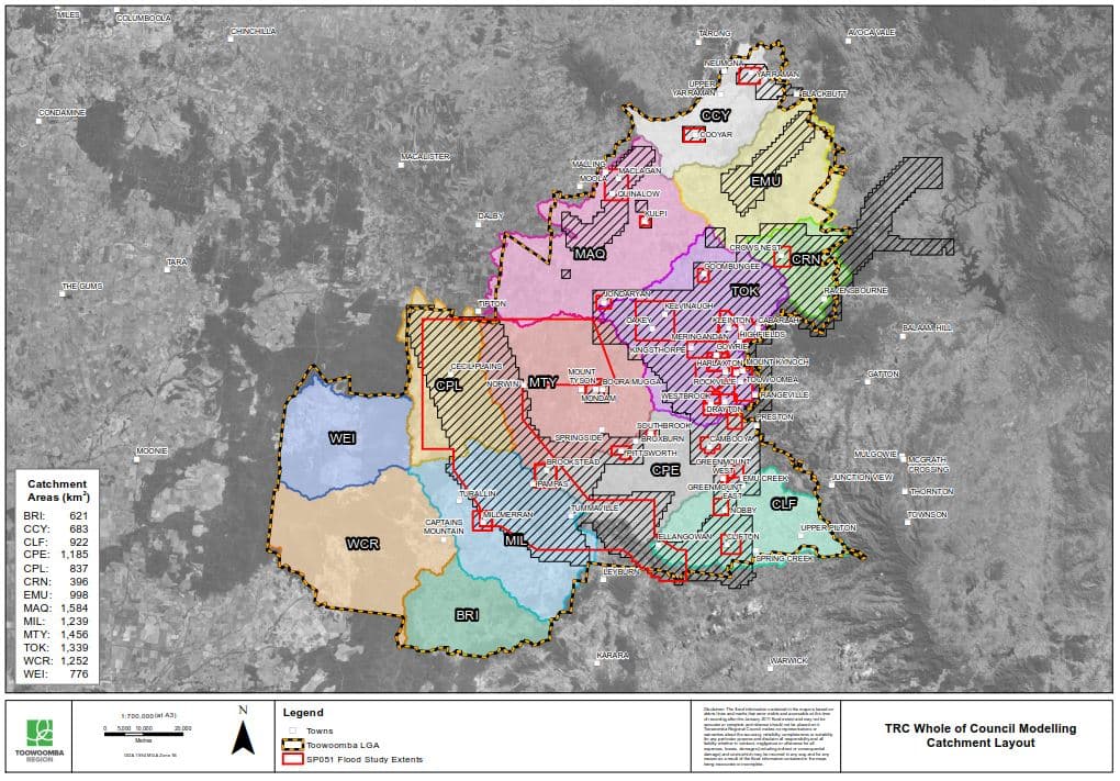
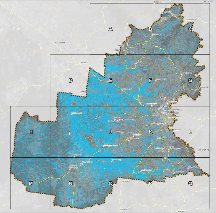
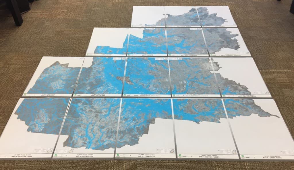
The TRC LGA was divided into 13 TUFLOW GPU models, utilising topographies with 10 m grid spacing created from a blend of LiDAR-derived DEM data and SRTM data. ARR 1987 rainfall was used to validate the results to existing flood studies. The design modelling was completed using ARR 2016 rainfall and was validated using RFFE techniques. The final product included a seamless 1% AEP flood extent for Toowoomba LGA developed from a combination of the 35 flood study results and the new GPU direct rainfall results.

The mapped 1% AEP flood extent is being used to inform emergency management, planning scheme updates and to assist with targeting future study areas. In addition to modelling and mapping of results for the 1% AEP event, models were also set up for the 2%, 10%, 20% and 50% AEP design events to enable Council to run the models in-house at a later stage.

Local Council catchment layout (diagram)
Local council mapLocal Government map

Related Projects

Hay Street Pedestrian Bridge
Brisbane City Council

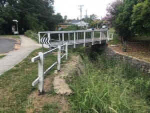
Hay Street Pedestrian Bridge Replacement

The objective of this project was to undertake hydraulic modelling and flood impact assessment to inform the design of the new bridge.
Sunshine Coast Storm Surge
Sunshine Coast Regional Council (SCRC)

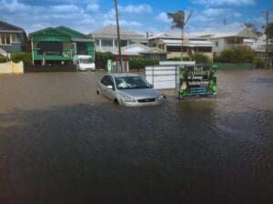
Sunshine Coast Extreme Flood Hazard Mapping

Filling a Knowledge Gap on Flood Severity in Rare Events
Marshall Precinct
City of Greater Geelong

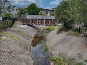
Marshall Precinct Stormwater Management Strategy

The primary aim of the SWMS is to investigate the impact that the transition from rural residential land uses into predominantly urban, residential development will have on surface water within and beyond the PSP boundary.
Auckland Creek
Gladstone Regional Council

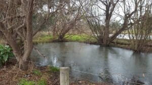
Auckland Creek Flood Study

Gladstone Regional Council commissioned WMS to update existing hydrologic and hydraulic models for Auckland Creek and undertake a new flood study of Auckland Creek.
Road near Drummond Creek
Isaac Regional Council

Design of Drummond Creek Floodway

A new floodway design improving flood immunity whilst maintaining design speed requirements
Collinson McKinnon Basin
Cairns Regional Council

McKinnon Creek Detention Basin Failure Impact Assessment

WMS was engaged to undertake a comprehensive Failure Impact Assessment (FIA) for the McKinnon Creek Detention Basin
Pallamallawa and community involvement
Moree Plains Shire Council

PALLAMALLAWA LEVEE DESIGN REVIEW

WMS partnered with Dryside Engineering to deliver the Pallamallawa Northern Levee Second Design Review